
1964 Map of Markle Pass
USGS Topo · Published 1967About this map
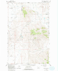
Hot Springs sits at the northern edge of this high-plateau landscape, where the Hot Springs Creek and Garden Cr converge. The terrain is defined by the sharp transition from the level floor of the Camas Prairie Basin to the steep slopes of Schmitz Mountain and the prominent Markle Pass. This mid-1960s survey documents a landscape of sparse ranching and infrastructure within the Flathead Indian Reservation, marked by isolated landmarks like the Radio Tower and the small Hot Springs Landing Strip.
Find a feature on this map
21 named features on this map. Tap any name to fly to it.
Don’t see what you’re looking for? This feature index may not catch every label — zoom into the map to look around manually.
Map Details
Editions of this 1964 Markle Pass Map
2 editions found
Other maps of this area

1920 · Flathead Lake
USGS Topo · 1:125,000

1956 · Wallace
USGS Topo · 1:250,000

1959 · Perma
USGS Topo · 1:62,500

1960 · Wallace
USGS Topo · 1:250,000

1964 · Melton Ranch
USGS Topo · 1:24,000

1964 · Lonepine
USGS Topo · 1:24,000

1964 · Hot Springs
USGS Topo · 1:24,000
1964 · Hot Springs NE
USGS Topo · 1:24,000

1965 · Oliver Point
USGS Topo · 1:24,000
1965 · Irvine Hill
USGS Topo · 1:24,000