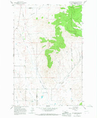
1964 Map of Hot Springs NE
USGS Topo · Published 1967About this map
The Little Bitterroot River winds through this 1964 survey of the Flathead Indian Reservation, marking the transition between the basin floor and the rising uplands of the Cabinet Mountains. The small settlement of Camas sits in the western valley, supported by the engineered water management of the Camas Canal and nearby Flowing Well sites that hint at the region's agricultural and geothermal history.
Find a feature on this map
14 named features on this map. Tap any name to fly to it.
Don’t see what you’re looking for? This feature index may not catch every label — zoom into the map to look around manually.
Map Details
Editions of this 1964 Hot Springs NE Map
This is the sole edition of this map. No revisions or reprints were ever made.
Other maps of this area

1920 · Flathead Lake
USGS Topo · 1:125,000

1956 · Wallace
USGS Topo · 1:250,000

1960 · Wallace
USGS Topo · 1:250,000

1964 · Irvine Lookout Tower
USGS Topo · 1:24,000

1964 · Mill Pocket Creek
USGS Topo · 1:24,000

1964 · Markle Pass
USGS Topo · 1:24,000

1964 · Lonepine
USGS Topo · 1:24,000

1964 · Hot Springs
USGS Topo · 1:24,000
1964 · Niarada
USGS Topo · 1:24,000

1965 · Oliver Point
USGS Topo · 1:24,000