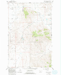
1964 Map of Markle Pass
USGS Topo · Published 1992About this map
The Flathead Indian Reservation dominates this 1964 survey of the western Montana landscape, where the Little Bitterroot River and Dry Fork Creek carve through the foothills near the border of Sanders and Lake counties. The map captures a transition between the elevated heights of Schmitz Mountain and the expansive Camas Prairie Basin to the south.
Find a feature on this map
20 named features on this map. Tap any name to fly to it.
Don’t see what you’re looking for? This feature index may not catch every label — zoom into the map to look around manually.
Map Details
Editions of this 1964 Markle Pass Map
2 editions found
Other maps of this area

1920 · Flathead Lake
USGS Topo · 1:125,000

1956 · Wallace
USGS Topo · 1:250,000

1959 · Perma
USGS Topo · 1:62,500

1960 · Wallace
USGS Topo · 1:250,000

1964 · Melton Ranch
USGS Topo · 1:24,000

1964 · Markle Pass
USGS Topo · 1:24,000

1964 · Lonepine
USGS Topo · 1:24,000

1964 · Hot Springs
USGS Topo · 1:24,000
1964 · Hot Springs NE
USGS Topo · 1:24,000

1965 · Oliver Point
USGS Topo · 1:24,000