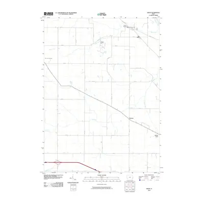
2010 Map of Dixon
USGS Topo · Published 2010About this map
The Wapsipinicon River clips the northeastern corner of this Iowa landscape, defining the northern boundary of a region dominated by agricultural grid-lines and scattered settlements. The community of Dixon sits near the river bend, anchored by the Dixon Post Office and the nearby Dixon Cemetery. To the south and east, the map reveals the distinct locations of New Dixon and Plainview, settlements linked by a network of straight-line section roads like Buena Vista Rd and 270th St.
Find a feature on this map
36 named features on this map. Tap any name to fly to it.
Don’t see what you’re looking for? This feature index may not catch every label — zoom into the map to look around manually.
Map Details
Editions of this 2010 Dixon Map
This is the sole edition of this map. No revisions or reprints were ever made.
Other maps of this area

1890 · Durant
USGS Topo · 1:62,500

1891 · DeWitt
USGS Topo · 1:62,500

1891 · Davenport
USGS Topo · 1:62,500

1892 · Wheatland
USGS Topo · 1:62,500

1894 · Wheatland
USGS Topo · 1:62,500

1894 · Durant
USGS Topo · 1:62,500

1894 · Davenport
USGS Topo · 1:62,500

1901 · Rock Island
USGS Topo · 1:125,000

1910 · Rock Island
USGS Topo · 1:125,000
1953 · Donahue
USGS Topo · 1:24,000