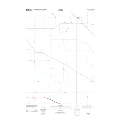
2013 Map of Dixon
USGS Topo · Published 2013About this map
The agrarian landscape surrounding Dixon and New Dixon is defined by a grid of rural roads and the winding paths of several creeks. In the northeastern portion of the sheet, the village of Dixon sits at the junction of Big Rock Rd and High St, with the newer settlement of New Dixon positioned just to the southeast. The area is intersected by numerous watercourses, including Walnut Cr and Mud Cr, which dictate the placement of local homesteads and farmsteads throughout the township.
Find a feature on this map
39 named features on this map. Tap any name to fly to it.
Don’t see what you’re looking for? This feature index may not catch every label — zoom into the map to look around manually.
Map Details
Editions of this 2013 Dixon Map
This is the sole edition of this map. No revisions or reprints were ever made.
Other maps of this area

1890 · Durant
USGS Topo · 1:62,500

1891 · DeWitt
USGS Topo · 1:62,500

1891 · Davenport
USGS Topo · 1:62,500

1892 · Wheatland
USGS Topo · 1:62,500

1894 · Wheatland
USGS Topo · 1:62,500

1894 · Durant
USGS Topo · 1:62,500

1894 · Davenport
USGS Topo · 1:62,500

1901 · Rock Island
USGS Topo · 1:125,000

1910 · Rock Island
USGS Topo · 1:125,000
1953 · Donahue
USGS Topo · 1:24,000