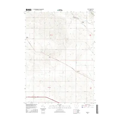
2015 Map of Dixon
USGS Topo · Published 2015About this map
Dixon and its neighboring settlements occupy the rolling farmland of Scott County, where the transition between the upper plains and local creek valleys defines the landscape. In the northern reaches, New Dixon sits near the winding course of Walnut Cr, while the village of Plainview anchors the southeastern portion along New Liberty Rd. The map illustrates a meticulously organized section and range system, where early 21st-century agricultural life is framed by a dense grid of gravel and paved roads including Allens Grove Rd and 75th Ave. Researchers will find significant local history preserved at the Dixon Cem and Round Grove Cem, both established near major drainage basins like Mud Cr. The terrain is characterized by the subtle incision of waterways such as Hickory Cr and Big Elkhorn Cr, which provided the natural drainage essential for the region's long-standing farming tradition.
Find a feature on this map
44 named features on this map. Tap any name to fly to it.
Don’t see what you’re looking for? This feature index may not catch every label — zoom into the map to look around manually.
Map Details
Editions of this 2015 Dixon Map
This is the sole edition of this map. No revisions or reprints were ever made.
Other maps of this area

1890 · Durant
USGS Topo · 1:62,500

1891 · DeWitt
USGS Topo · 1:62,500

1891 · Davenport
USGS Topo · 1:62,500

1892 · Wheatland
USGS Topo · 1:62,500

1894 · Wheatland
USGS Topo · 1:62,500

1894 · Durant
USGS Topo · 1:62,500

1894 · Davenport
USGS Topo · 1:62,500

1901 · Rock Island
USGS Topo · 1:125,000

1910 · Rock Island
USGS Topo · 1:125,000
1953 · Donahue
USGS Topo · 1:24,000