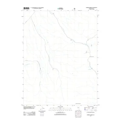
2012 Map of Dobbin Summit
USGS Topo · Published 2012About this map
Dobbin Summit and Black Rock Mountain anchor this high-elevation landscape in the Nye County wilderness. The area is defined by a dendritic network of drainages including West Dobbin Creek and Wadsworth Creek, which carve through the terrain as it appeared in the early 21st century. This map reveals the intricate access routes managed by the Forest Service, such as Natl Forest Develop Road 366 Rd and Natl Forest Develop Road 365 Rd, which provide passage through the upland territory. A critical water source in this arid environment is identified at East Dobbin Summit Spring, situated just below the primary peak. The absence of permanent settlements emphasizes the character of the region as a protected natural resource and recreation area within the national forest system.
Find a feature on this map
11 named features on this map. Tap any name to fly to it.
Don’t see what you’re looking for? This feature index may not catch every label — zoom into the map to look around manually.
Map Details
Editions of this 2012 Dobbin Summit Map
This is the sole edition of this map. No revisions or reprints were ever made.
Other maps of this area

1926 · Roberts Mountains
USGS Topo · 1:250,000

1929 · Roberts Mountains
USGS Topo · 1:250,000

1955 · Millett
USGS Topo · 1:250,000

1956 · Horse Heaven Mtn
USGS Topo · 1:62,500

1956 · Tonopah
USGS Topo · 1:250,000

1959 · Tonopah
USGS Topo · 1:250,000

1959 · Millett
USGS Topo · 1:250,000

1960 · Dianas Punch Bowl
USGS Topo · 1:62,500

1962 · Tonopah
USGS Topo · 1:250,000

1968 · Fish Springs
USGS Topo · 1:62,500