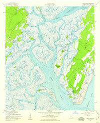
1954 Map of Doboy Sound
USGS Topo · Published 1959About this map
Sapelo Island dominates this coastal survey, revealing the intricate geography of the Georgia sea islands in the mid-1950s. The landscape is defined by a complex network of tidal passages, including the Intracoastal Waterway as it winds through Old Teakettle Creek and Doboy Sound. On the eastern shores, the community of Sapelo and the settlement at Hog Hammock appear alongside private roads and landing fields, while the mainland village of Valona serves as a western anchor near Elm Grove Ch. The map provides detailed soundings and highlights the numerous hammocks and islands—such as Pumpkin Hammock, Mary Hammock, and Creighton Island—that characterize this salt marsh environment. This survey captures the region before modern development, showing the reliance on water transport and the isolated nature of the barrier island settlements.
Find a feature on this map
49 named features on this map. Tap any name to fly to it.
Don’t see what you’re looking for? This feature index may not catch every label — zoom into the map to look around manually.
Map Details
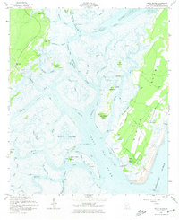
Editions of this 1954 Doboy Sound Map
2 editions found
Other maps of this area

1920 · Sapelo River
USGS Topo · 1:62,500

1920 · Cabretta Island
USGS Topo · 1:62,500

1921 · Darien
USGS Topo · 1:62,500

1928 · St Catherines Island
USGS Topo · 1:62,500

1943 · St Catherines Island
USGS Topo · 1:62,500

1943 · Sapelo River
USGS Topo · 1:62,500

1944 · Cabretta Island
USGS Topo · 1:62,500

1945 · St. Catherine's Island
USGS Topo · 1:62,500

1945 · Sapelo River
USGS Topo · 1:62,500

1946 · Brunswick
USGS Topo · 1:250,000