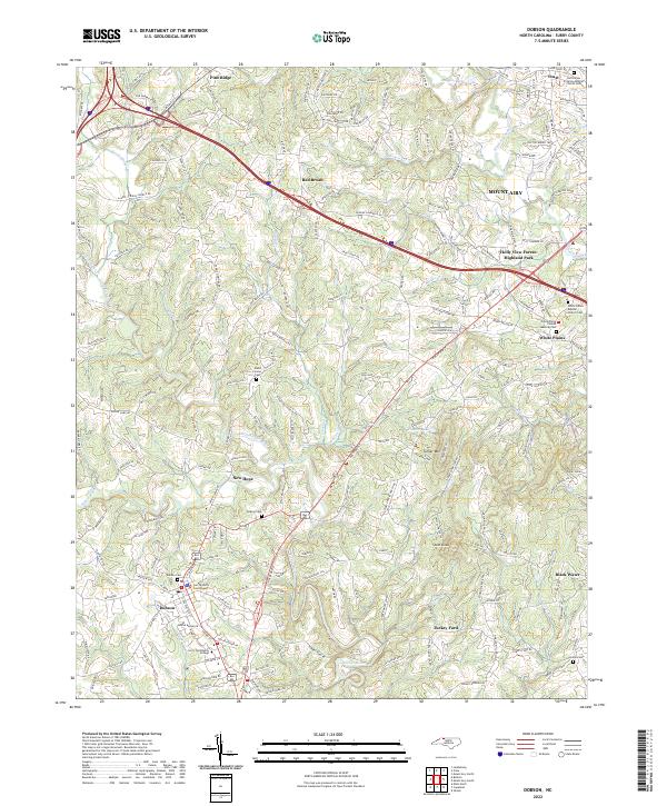
2022 Map of Dobson
USGS Topo · Published 2022About this map
Dobson serves as a central hub on this North Carolina landscape, where the Surry County Courthouse and Surry Community College define the town's civic character. The terrain is intricately carved by the Fisher River and its numerous tributaries, including Stewarts Creek, Little Fisher River, and Cooks Cr, which weave through the rolling foothills. Local history is deeply embedded in the distribution of community spaces, from the established settlement at White Plains to smaller hamlets like Red Brush, Pine Ridge, and Turkey Ford.
Find a feature on this map
182 named features on this map. Tap any name to fly to it.
Don’t see what you’re looking for? This feature index may not catch every label — zoom into the map to look around manually.
Map Details
Editions of this 2022 Dobson Map
This is the sole edition of this map. No revisions or reprints were ever made.
Other maps of this area

1889 · Hillsville
USGS Topo · 1:125,000

1891 · Yadkinville
USGS Topo · 1:125,000

1892 · Hillsville
USGS Topo · 1:125,000

1893 · Yadkinville
USGS Topo · 1:125,000

1896 · Hillsville
USGS Topo · 1:125,000

1931 · Galax
USGS Topo · 1:48,000

1933 · Galax
USGS Topo · 1:62,500

1953 · Winston-Salem
USGS Topo · 1:250,000

1955 · Winston-Salem
USGS Topo · 1:250,000

1957 · Mount Airy
USGS Topo · 1:62,500