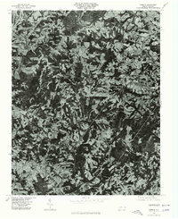
1976 Map of Dobson
USGS Topo · Published 1979About this map
Dobson serves as a primary hub in this mid-1970s orthophotoquad, which uses aerial photography to document the Surry County landscape. The settlement patterns follow the winding paths of the Fisher River and the Little Fisher River, where small communities like New Hope and Turkey Ford are clearly visible against the patchwork of agricultural fields and woodland. The orthophoto format provides a unique perspective on the rural character of the area, showing the density of forest cover and the precise layout of local homesteads near White Plains and Toast. To the north, the elevation rises toward Pine Ridge, while Stewarts Creek drains the eastern portion of the quadrangle. This document preserves the physical geography and land-use patterns of the region before further modern development, offering a clear view of the area's transition between several small named localities including Blackwater and Red Brush.
Find a feature on this map
11 named features on this map. Tap any name to fly to it.
Don’t see what you’re looking for? This feature index may not catch every label — zoom into the map to look around manually.
Map Details
Editions of this 1976 Dobson Map
This is the sole edition of this map. No revisions or reprints were ever made.
Other maps of this area

1889 · Hillsville
USGS Topo · 1:125,000

1891 · Yadkinville
USGS Topo · 1:125,000

1892 · Hillsville
USGS Topo · 1:125,000

1893 · Yadkinville
USGS Topo · 1:125,000

1896 · Hillsville
USGS Topo · 1:125,000

1931 · Galax
USGS Topo · 1:48,000

1933 · Galax
USGS Topo · 1:62,500

1953 · Winston-Salem
USGS Topo · 1:250,000

1955 · Winston-Salem
USGS Topo · 1:250,000

1957 · Mount Airy
USGS Topo · 1:62,500