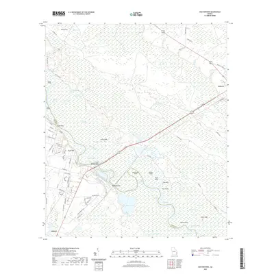
2020 Map of Doctortown
USGS Topo · Published 2020About this map
The Altamaha River carves a winding path through this corner of southeast Georgia, defining the boundary between Long County and Wayne County. The settlement of Doctortown occupies a prominent bend in the river, situated near the J Alvin Leaphart-Senior Memorial Bridge. This landscape is characterized by a complex network of wetlands and riverine features, including the expansive Patterson Swamp and Vinzant Swamp. To the southwest, the outskirts of Jesup begin to appear, while Ludowici sits to the northeast, connected by the highway corridor. Local industrial and natural features such as Rayonier Lake and Rayonier Lake South contrast with the numerous islands and bluffs that line the river, including Lake Bluff, Knee Buckle Island, and Shoe Island.
Find a feature on this map
88 named features on this map. Tap any name to fly to it.
Don’t see what you’re looking for? This feature index may not catch every label — zoom into the map to look around manually.
Map Details
Editions of this 2020 Doctortown Map
This is the sole edition of this map. No revisions or reprints were ever made.
Other maps of this area

1918 · Jesup
USGS Topo · 1:62,500

1918 · Hinesville
USGS Topo · 1:62,500

1920 · Glennville
USGS Topo · 1:62,500

1943 · Ludowici
USGS Topo · 1:62,500

1943 · Jesup
USGS Topo · 1:62,500

1944 · Glennville
USGS Topo · 1:62,500

1944 · Hinesville
USGS Topo · 1:62,500

1946 · Brunswick
USGS Topo · 1:250,000

1948 · Brunswick
USGS Topo · 1:250,000

1950 · Glennville
USGS Topo · 1:62,500