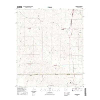
2014 Map of Doddridge
USGS Topo · Published 2014About this map
Arkansas and Louisiana meet along a border defined by the rural landscapes of Miller and Caddo Parishes. The terrain is a complex network of waterways, centered on the E Fork Kelly Bayou and W Fork Kelly Bayou which snake through the timbered lowlands. Settlements like Doddridge and Brightstar serve as focal points for this agricultural and extractive region, while the Rodessa Oil and Gas Field indicates the subsurface industrial activity that has long shaped the local economy. Small rural communities such as Kiblah and Capps City are connected by a web of county roads and private tracks, illustrating the dispersed nature of habitation in the early 21st century. Geographers and local historians will find interest in the scattered burial grounds like Sulphur Fork Cemetery and New Hope Cemetery, alongside numerous small lakes such as Jones Lake and Westmoreland Lake that dot the drainage basin.
Find a feature on this map
83 named features on this map. Tap any name to fly to it.
Don’t see what you’re looking for? This feature index may not catch every label — zoom into the map to look around manually.
Map Details
Editions of this 2014 Doddridge Map
This is the sole edition of this map. No revisions or reprints were ever made.
Other maps of this area

1907 · Atlanta
USGS Topo · 1:62,500

1910 · Atlanta
USGS Topo · 1:62,500

1932 · Hosston NW
USGS Topo · 1:31,680

1932 · Hosston NE
USGS Topo · 1:31,680

1944 · Kildare
USGS Topo · 1:62,500

1948 · Kildare
USGS Topo · 1:62,500

1948 · Vivian
USGS Topo · 1:62,500

1952 · Doddridge SE
USGS Topo · 1:24,000

1952 · Doddridge NW
USGS Topo · 1:24,000

1952 · Doddridge
USGS Topo · 1:24,000