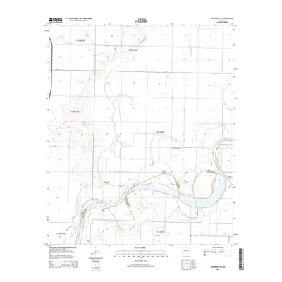
2014 Map of Doddridge NE
USGS Topo · Published 2014About this map
The Red River carves a serpentine path through the borderlands of Miller and Lafayette counties, defining the southern landscape with its dramatic meanders and cutoffs. The hydrology here is complex, characterized by the Old Channel McKinney Bayou and various oxbows such as Haley Lake and Goose Lake that mark the river's historical shifts. Named river features like Slay Bend, Brown Bend, and Dickson Bend indicate the agricultural and navigational importance of these specific alluvial pockets, while Hunters Island sits within the riparian corridor. The settlement of Fairland serves as the primary upland anchor in the north, connected by a network of county roads including Ar-134 and Ar-160. Further south, Beloh Bridge provides a crossing point over the bayou, illustrating the intersection of transportation and the watery terrain of the Red River valley.
Find a feature on this map
45 named features on this map. Tap any name to fly to it.
Don’t see what you’re looking for? This feature index may not catch every label — zoom into the map to look around manually.
Map Details
Editions of this 2014 Doddridge NE Map
This is the sole edition of this map. No revisions or reprints were ever made.
Other maps of this area

1952 · Doddridge SE
USGS Topo · 1:24,000

1952 · Bradley
USGS Topo · 1:24,000

1952 · Garland
USGS Topo · 1:24,000

1952 · Doddridge NW
USGS Topo · 1:24,000

1952 · Doddridge
USGS Topo · 1:24,000

1952 · Fouke SE
USGS Topo · 1:24,000

1952 · Doddridge NE
USGS Topo · 1:24,000

1952 · Fouke
USGS Topo · 1:24,000

1952 · Canfield
USGS Topo · 1:24,000

1953 · El Dorado
USGS Topo · 1:250,000