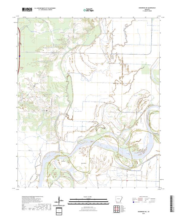
2024 Map of Doddridge NE
USGS Topo · Published 2024About this map
The Red River carves a winding path through this corner of Southwest Arkansas, defining the boundary between Miller and Lafayette counties. The landscape is characterized by the complex hydrography of the river valley, where abandoned meanders and oxbows have formed distinct features like Bee Lake, Haley Lake, and Oak Lake. Notable river landmarks including Slay Bend, Brown Bend, and Dickson Bend illustrate the shifting nature of the waterway, while the Old Channel McKinney Bayou traces a former course through the alluvial plain.
Find a feature on this map
46 named features on this map. Tap any name to fly to it.
Don’t see what you’re looking for? This feature index may not catch every label — zoom into the map to look around manually.
Map Details
Editions of this 2024 Doddridge NE Map
This is the sole edition of this map. No revisions or reprints were ever made.
Other maps of this area

1952 · Doddridge SE
USGS Topo · 1:24,000

1952 · Bradley
USGS Topo · 1:24,000

1952 · Garland
USGS Topo · 1:24,000

1952 · Doddridge NW
USGS Topo · 1:24,000

1952 · Doddridge
USGS Topo · 1:24,000

1952 · Fouke SE
USGS Topo · 1:24,000

1952 · Doddridge NE
USGS Topo · 1:24,000

1952 · Fouke
USGS Topo · 1:24,000

1952 · Canfield
USGS Topo · 1:24,000

1953 · El Dorado
USGS Topo · 1:250,000