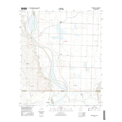
2017 Map of Doddridge SE
USGS Topo · Published 2017About this map
The Red River snakes through the heart of this landscape, defining the border between Miller County and Lafayette County before crossing the state line into Louisiana. This riverine environment is characterized by a complex network of backwaters and historical channels, including Old Channel McKinney Bayou, Blue Hole, and the oxbow-shaped Old Bed Rotten Lake. These features reveal the shifting nature of the river over time, leaving behind pockets of water like Palmer Lake and Missionary Lake that dictate the settlement patterns of the surrounding basin.
Find a feature on this map
54 named features on this map. Tap any name to fly to it.
Don’t see what you’re looking for? This feature index may not catch every label — zoom into the map to look around manually.
Map Details
Editions of this 2017 Doddridge SE Map
This is the sole edition of this map. No revisions or reprints were ever made.
Other maps of this area

1932 · Hosston NW
USGS Topo · 1:31,680

1932 · Hosston NE
USGS Topo · 1:31,680

1948 · Vivian
USGS Topo · 1:62,500

1950 · Plain Dealing NW
USGS Topo · 1:31,680

1952 · Doddridge SE
USGS Topo · 1:24,000

1952 · Bradley
USGS Topo · 1:24,000

1952 · Doddridge NW
USGS Topo · 1:24,000

1952 · Doddridge
USGS Topo · 1:24,000

1952 · Doddridge NE
USGS Topo · 1:24,000

1952 · Canfield
USGS Topo · 1:24,000