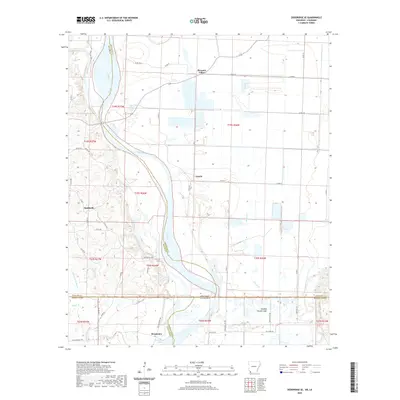
2020 Map of Doddridge SE
USGS Topo · Published 2020About this map
The Red River dominates this landscape along the state line where Arkansas and Louisiana meet, creating a complex network of waterways including the Sulphur River and the isolated Blue Hole. Small agricultural settlements like Canale and Pleasant Valley are linked by a grid of rural county roads such as Co RD 50 and Co RD 47. To the south, the community of Missionary sits near the namesake Missionary Lake, reflecting the early spiritual and social foundations of these river-valley townships. The presence of Blanton Cem and the unincorporated cluster of Smithville provide specific points of interest for those tracing family roots in this corner of Lafayette and Miller Counties. This 2020 map documents a low-lying terrain defined by active and dormant river channels, including Old Bed Rotten Lake and the meandering Dry Fork.
Find a feature on this map
53 named features on this map. Tap any name to fly to it.
Don’t see what you’re looking for? This feature index may not catch every label — zoom into the map to look around manually.
Map Details
Editions of this 2020 Doddridge SE Map
This is the sole edition of this map. No revisions or reprints were ever made.
Other maps of this area

1932 · Hosston NW
USGS Topo · 1:31,680

1932 · Hosston NE
USGS Topo · 1:31,680

1948 · Vivian
USGS Topo · 1:62,500

1950 · Plain Dealing NW
USGS Topo · 1:31,680

1952 · Doddridge SE
USGS Topo · 1:24,000

1952 · Bradley
USGS Topo · 1:24,000

1952 · Doddridge NW
USGS Topo · 1:24,000

1952 · Doddridge
USGS Topo · 1:24,000

1952 · Doddridge NE
USGS Topo · 1:24,000

1952 · Canfield
USGS Topo · 1:24,000