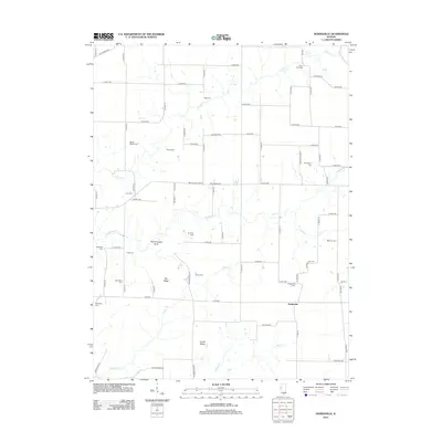
2012 Map of Doddsville
USGS Topo · Published 2012About this map
Doddsville anchors this section of the Illinois countryside, where a network of agricultural roads and scattered family burial grounds defines the landscape. The region is notable for its numerous small cemeteries, such as Bethel Baptist Cem, Vawter Cem, and Pennington Cem, which offer significant value for genealogical research. The terrain is marked by distinct landform names including The Thousand Acres and the elevated stretches of Gin Ridge and Center Ridge. Drainage flows through a series of creeks like Grindstone Cr and Willow Cr, which cut across the grid-iron road system. The presence of Hickory Grove Corner and roads with unique names like Invention Rd suggest the long-standing rural community identity maintained well into the twenty-first century.
Find a feature on this map
77 named features on this map. Tap any name to fly to it.
Don’t see what you’re looking for? This feature index may not catch every label — zoom into the map to look around manually.
Map Details
Editions of this 2012 Doddsville Map
This is the sole edition of this map. No revisions or reprints were ever made.
Other maps of this area

1912 · Macomb
USGS Topo · 1:62,500

1913 · Colchester
USGS Topo · 1:62,500

1914 · Macomb
USGS Topo · 1:62,500

1923 · Rushville
USGS Topo · 1:62,500

1926 · Rushville
USGS Topo · 1:62,500

1946 · Augusta
USGS Topo · 1:62,500

1949 · Augusta
USGS Topo · 1:62,500

1958 · Burlington
USGS Topo · 1:250,000

1961 · Burlington
USGS Topo · 1:250,000

1963 · Burlington
USGS Topo · 1:250,000