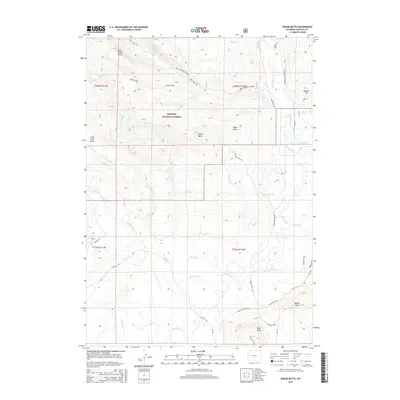
2015 Map of Dodge Butte
USGS Topo · Published 2015About this map
Bridger National Forest defines the western half of this Sublette County landscape, where the high country of Rock Creek Buttes and the Twin Creek Basin gives way to a network of drainage systems. The Green River carves a broad valley through the eastern portion of the quadrangle, joined by numerous tributaries including Badger Cr and Wagonfeur Cr. This hydrology supported the early development of the region, evidenced by the presence of the Tie Camp Cem in the northeast, a quiet marker of the era's timber and tie-cutting industry.
Find a feature on this map
42 named features on this map. Tap any name to fly to it.
Don’t see what you’re looking for? This feature index may not catch every label — zoom into the map to look around manually.
Map Details
Editions of this 2015 Dodge Butte Map
This is the sole edition of this map. No revisions or reprints were ever made.
Other maps of this area

1907 · Gros Ventre
USGS Topo · 1:125,000

1909 · Fremont Peak
USGS Topo · 1:125,000

1910 · Gros Ventre
USGS Topo · 1:125,000

1955 · Driggs
USGS Topo · 1:250,000

1955 · Thermopolis
USGS Topo · 1:250,000

1958 · Driggs
USGS Topo · 1:250,000

1958 · Thermopolis
USGS Topo · 1:250,000

1962 · Thermopolis
USGS Topo · 1:250,000

1962 · Driggs
USGS Topo · 1:250,000
1966 · Warren Bridge
USGS Topo · 1:24,000