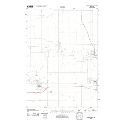
2010 Map of Dodge Center
USGS Topo · Published 2010About this map
Dodge Center and Kasson anchor the southern portion of this landscape, where the agricultural grid is interrupted by the meandering course of the South Branch Middle Fork Zumbro River. The map details the transition between these growing regional hubs and the smaller settlements of Wasioja and Mantorville to the north. A local hydraulic history is evident at the Mantorville Dam, while the presence of the Dodge Center Airport and the concentrated commercial infrastructure around the Kasson Post Office reflect the area's modern development as a transit and service center. For genealogists and local historians, several landmarks provide critical spatial context, including the Wildwood Cemetery near Wasioja and the Riverside Cemetery west of the central townships. The terrain is defined by a network of drainage creeks, such as Masten Creek and Milliken Creek, which shaped the early settlement patterns and subsequent road placement across this Dodge County territory.
Find a feature on this map
36 named features on this map. Tap any name to fly to it.
Don’t see what you’re looking for? This feature index may not catch every label — zoom into the map to look around manually.
Map Details
Editions of this 2010 Dodge Center Map
This is the sole edition of this map. No revisions or reprints were ever made.
Other maps of this area

1953 · Saint Paul
USGS Topo · 1:250,000

1954 · Mason City
USGS Topo · 1:250,000

1955 · High Forest
USGS Topo · 1:62,500

1957 · Mason City
USGS Topo · 1:250,000

1958 · Mason City
USGS Topo · 1:250,000

1959 · Saint Paul
USGS Topo · 1:250,000

1965 · Dodge Center
USGS Topo · 1:24,000

1965 · Concord
USGS Topo · 1:24,000

1965 · Claremont
USGS Topo · 1:24,000

1965 · West Concord
USGS Topo · 1:24,000