
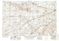
1955 Map of Dodge City
USGS Topo · Published 1968About this map
The Arkansas River and Cimarron River systems define this mid-century portrait of Southwest Kansas, showing the region at a time of significant agricultural and energy transition. The landscape is marked by the presence of numerous windmills and gas wells, particularly concentrated around settlements like Hugoton and Ulysses. These features, alongside the United States Soil Conservation Service Headquarters near Elkhart, reflect a post-Dust Bowl era of intensive land management and resource extraction.
Find a feature on this map
71 named features on this map. Tap any name to fly to it.
Don’t see what you’re looking for? This feature index may not catch every label — zoom into the map to look around manually.
Map Details
Editions of this 1955 Dodge City Map
3 editions found
Other maps of this area

1890 · Granada
USGS Topo · 1:125,000

1891 · Albany
USGS Topo · 1:125,000

1891 · Larned
USGS Topo · 1:125,000

1892 · Ness
USGS Topo · 1:125,000

1892 · Meade
USGS Topo · 1:125,000

1892 · Dodge
USGS Topo · 1:125,000

1892 · Vilas
USGS Topo · 1:125,000

1892 · Granada
USGS Topo · 1:125,000

1892 · Spearville
USGS Topo · 1:125,000

1893 · Albany
USGS Topo · 1:125,000