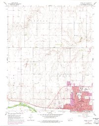
1968 Map of Dodge City
USGS Topo · Published 1978About this map
The Old Indian Treaty Boundary slices diagonally across the landscape north of the Arkansas River, a stark cartographic reminder of the region's complex 19th-century history. In Dodge City, the urban footprint expands northward from the historic riverfront, anchored by civic and educational institutions like St Mary of the Plains College, St Anthony Hospital, and the local Courthouse. This late 1960s survey, updated with late 1970s aerial photography, shows the density of the city's street grid, featuring historic thoroughfares such as Wyatt Earp Blvd and Front St. The industrial and logistics backbone of the area is clearly defined by the Atchison Topeka and Santa Fe railroad corridor. Beyond the city limits, the terrain transitions into the townships of Royal and Grandview, where the land is carved by Duck Creek and Saw Log Creek.
Find a feature on this map
44 named features on this map. Tap any name to fly to it.
Don’t see what you’re looking for? This feature index may not catch every label — zoom into the map to look around manually.
Map Details
Editions of this 1968 Dodge City Map
3 editions found

Other maps of this area

1892 · Dodge
USGS Topo · 1:125,000

1892 · Spearville
USGS Topo · 1:125,000

1894 · Spearville
USGS Topo · 1:125,000

1955 · Pratt
USGS Topo · 1:250,000

1955 · Dodge City
USGS Topo · 1:250,000

1958 · Dodge City
USGS Topo · 1:250,000

1959 · Pratt
USGS Topo · 1:250,000

1959 · Dodge City
USGS Topo · 1:250,000

1968 · Dodge City NE
USGS Topo · 1:24,000

1968 · Dodge City NW
USGS Topo · 1:24,000