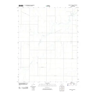
2009 Map of Dodge City NW
USGS Topo · Published 2009About this map
Buckner Creek and its tributary, the South Fork Buckner Creek, wind through the high plains of Ford County in this 2009 USGS survey. The landscape is defined by the sharp geometry of the Public Land Survey System, where a grid of section-line roads facilitates agricultural movement across the prairie. Routes such as Backtrail Rd and Chestnut Rd divide the open country, while north-south corridors like 101 Rd and 102 Rd connect isolated farmsteads to the wider region. This map illustrates the intersection of natural drainage systems and modern rural infrastructure, showing how the meandering watercourses of the Buckner Creek basin remain the primary relief in an otherwise strictly organized agricultural landscape.
Find a feature on this map
10 named features on this map. Tap any name to fly to it.
Don’t see what you’re looking for? This feature index may not catch every label — zoom into the map to look around manually.
Map Details
Editions of this 2009 Dodge City NW Map
This is the sole edition of this map. No revisions or reprints were ever made.
Other maps of this area

1892 · Dodge
USGS Topo · 1:125,000

1955 · Dodge City
USGS Topo · 1:250,000

1955 · Scott City
USGS Topo · 1:250,000

1958 · Dodge City
USGS Topo · 1:250,000

1958 · Scott City
USGS Topo · 1:250,000

1959 · Dodge City
USGS Topo · 1:250,000

1968 · Dodge City NE
USGS Topo · 1:24,000

1968 · Dodge City NW
USGS Topo · 1:24,000

1968 · Cimarron
USGS Topo · 1:24,000

1968 · Cimarron NE
USGS Topo · 1:24,000