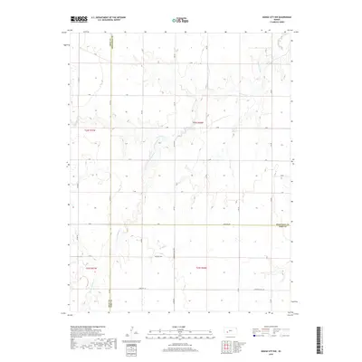
2018 Map of Dodge City NW
USGS Topo · Published 2018About this map
Buckner Creek and its tributary, South Fork Buckner Creek, meander through the high plains of Southwest Kansas, defining the drainage patterns across this rural landscape. This modern survey illustrates the precise tri-county intersection of Gray, Hodgeman, and Ford counties. The map details a strictly regulated grid of section lines and township boundaries, including t24s r26w and t25s r27w, which organize the agricultural territory. While few structures are named, the naming of local routes such as Community Hall Rd, Backtrail Rd, and Antelope Rd suggests the enduring pathways of local commerce and social gathering in a region defined by its wide-open ranching and farming acreage.
Find a feature on this map
35 named features on this map. Tap any name to fly to it.
Don’t see what you’re looking for? This feature index may not catch every label — zoom into the map to look around manually.
Map Details
Editions of this 2018 Dodge City NW Map
This is the sole edition of this map. No revisions or reprints were ever made.
Other maps of this area

1892 · Dodge
USGS Topo · 1:125,000

1955 · Dodge City
USGS Topo · 1:250,000

1955 · Scott City
USGS Topo · 1:250,000

1958 · Dodge City
USGS Topo · 1:250,000

1958 · Scott City
USGS Topo · 1:250,000

1959 · Dodge City
USGS Topo · 1:250,000

1968 · Dodge City NE
USGS Topo · 1:24,000

1968 · Dodge City NW
USGS Topo · 1:24,000

1968 · Cimarron
USGS Topo · 1:24,000

1968 · Cimarron NE
USGS Topo · 1:24,000