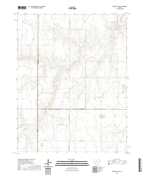
2022 Map of Dodge City NW
USGS Topo · Published 2022About this map
Buckner Creek and its southern branch, the South Fork Buckner Creek, carve a complex drainage pattern across this prairie landscape where three Kansas counties meet. The convergence of Gray, Hodgeman, and Ford counties is clearly marked, revealing a region defined by a rigorous section-line road grid that overlays the natural topography. These watercourses provide the primary relief in an otherwise expansive agricultural terrain.
Find a feature on this map
35 named features on this map. Tap any name to fly to it.
Don’t see what you’re looking for? This feature index may not catch every label — zoom into the map to look around manually.
Map Details
Editions of this 2022 Dodge City NW Map
This is the sole edition of this map. No revisions or reprints were ever made.
Other maps of this area

1892 · Dodge
USGS Topo · 1:125,000

1955 · Dodge City
USGS Topo · 1:250,000

1955 · Scott City
USGS Topo · 1:250,000

1958 · Dodge City
USGS Topo · 1:250,000

1958 · Scott City
USGS Topo · 1:250,000

1959 · Dodge City
USGS Topo · 1:250,000

1968 · Dodge City NE
USGS Topo · 1:24,000

1968 · Dodge City NW
USGS Topo · 1:24,000

1968 · Cimarron
USGS Topo · 1:24,000

1968 · Cimarron NE
USGS Topo · 1:24,000