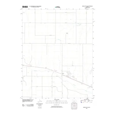
2009 Map of Dodge City SW
USGS Topo · Published 2009About this map
Howell sits as a primary collection of buildings along the northern bank of the Arkansas River, which cuts diagonally across the southern half of this landscape. The settlement's layout is defined by the proximity of major transit routes and the river's broad channel. North of the river valley, the terrain transitions into a grid-dominated rural landscape, where Saw Log Creek meanders toward the southeast. This area is characterized by long, straight section-line roads such as Foothill Rd and Iron Rd, which facilitate agricultural movement across the plains. A notable site for local genealogy is the Ridenour Cemetery, located in the north-central portion of the map. The spatial relationship between the river, the settlement at Howell, and the outlying farm roads like Jewell Rd illustrates the classic development pattern of western Kansas agricultural communities in the early 21st century.
Find a feature on this map
20 named features on this map. Tap any name to fly to it.
Don’t see what you’re looking for? This feature index may not catch every label — zoom into the map to look around manually.
Map Details
Editions of this 2009 Dodge City SW Map
This is the sole edition of this map. No revisions or reprints were ever made.
Other maps of this area

1892 · Dodge
USGS Topo · 1:125,000

1955 · Dodge City
USGS Topo · 1:250,000

1958 · Dodge City
USGS Topo · 1:250,000

1959 · Dodge City
USGS Topo · 1:250,000

1968 · Dodge City NE
USGS Topo · 1:24,000

1968 · Dodge City NW
USGS Topo · 1:24,000

1968 · Cimarron
USGS Topo · 1:24,000

1968 · Cimarron NE
USGS Topo · 1:24,000

1968 · Dodge City
USGS Topo · 1:24,000
1968 · Dodge City SW
USGS Topo · 1:24,000