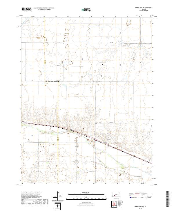
2022 Map of Dodge City SW
USGS Topo · Published 2022About this map
The Arkansas River winds through the southern reaches of this landscape west of Dodge City, marking a significant transition in the topography of Ford and Gray counties. The small settlement of Howell is positioned along the northern bank of the river, serving as a focal point for the local agricultural network. This area is defined by its sectional grid system, with long-established routes such as Iron Rd and Garnett Rd providing access to the fertile plains between the river and the northern drainage basins.
Find a feature on this map
22 named features on this map. Tap any name to fly to it.
Don’t see what you’re looking for? This feature index may not catch every label — zoom into the map to look around manually.
Map Details
Editions of this 2022 Dodge City SW Map
This is the sole edition of this map. No revisions or reprints were ever made.
Other maps of this area

1892 · Dodge
USGS Topo · 1:125,000

1955 · Dodge City
USGS Topo · 1:250,000

1958 · Dodge City
USGS Topo · 1:250,000

1959 · Dodge City
USGS Topo · 1:250,000

1968 · Dodge City NE
USGS Topo · 1:24,000

1968 · Dodge City NW
USGS Topo · 1:24,000

1968 · Cimarron
USGS Topo · 1:24,000

1968 · Cimarron NE
USGS Topo · 1:24,000

1968 · Dodge City
USGS Topo · 1:24,000
1968 · Dodge City SW
USGS Topo · 1:24,000