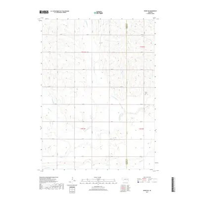
2017 Map of Dodge SW
USGS Topo · Published 2017About this map
The agricultural landscape of the Nebraska plains defines this area at the border of Colfax and Dodge Counties. The terrain is shaped by a dense network of waterways, most notably the winding paths of E Fork Maple Cr, W Fork Maple Cr, and Maple Cr. These streams are complemented by engineered features such as the Kasal Canal, illustrating the importance of water management to local farming. Historically minded researchers will find the Saint Patricks Cem in the eastern portion of the quadrangle, a landmark that often serves as a focal point for family history in rural townships. The map also records several smaller named tributaries, including W-Nadrchals Minnow Cr, Dry Cr, and Pond Cr, which feed into the larger drainage systems like Rawhide Cr in the south.
Find a feature on this map
26 named features on this map. Tap any name to fly to it.
Don’t see what you’re looking for? This feature index may not catch every label — zoom into the map to look around manually.
Map Details
Editions of this 2017 Dodge SW Map
This is the sole edition of this map. No revisions or reprints were ever made.
Other maps of this area

1899 · Wahoo
USGS Topo · 1:125,000

1899 · David City
USGS Topo · 1:125,000

1955 · Fremont
USGS Topo · 1:250,000

1957 · Fremont
USGS Topo · 1:250,000

1958 · Fremont
USGS Topo · 1:250,000

1966 · Webster
USGS Topo · 1:24,000

1966 · Snyder
USGS Topo · 1:24,000

1966 · Clarkson
USGS Topo · 1:24,000

1966 · Dodge SW
USGS Topo · 1:24,000
1966 · Dodge
USGS Topo · 1:24,000