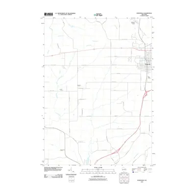
2010 Map of Dodgeville
USGS Topo · Published 2010About this map
The city of Dodgeville serves as the focal point of this Iowa County landscape, where the urban grid meets a complex network of rural roads and drainage basins. Situated at the headwaters of the Dodge Branch, the area's development is anchored by significant infrastructure, including the Dodgeville Municipal Airport and the Iowa County Airport. The surrounding countryside is defined by agricultural tracts and a series of northward-flowing streams such as Harker Creek, Laxey Creek, and Martin Creek. Historical continuity is represented by the several rural burying grounds that dot the territory, including Bloomfield Cemetery, Laxey Cemetery, and Saint Joseph Cemetery. The presence of Military Ridge Rd running west to east provides a clear indication of the regional transportation corridors that have shaped the settlement patterns of this part of Wisconsin since the mid-19th century.
Find a feature on this map
51 named features on this map. Tap any name to fly to it.
Don’t see what you’re looking for? This feature index may not catch every label — zoom into the map to look around manually.
Map Details
Editions of this 2010 Dodgeville Map
This is the sole edition of this map. No revisions or reprints were ever made.
Other maps of this area

1902 · Mineral Point
USGS Topo · 1:125,000

1905 · Richland Center
USGS Topo · 1:125,000

1952 · Mineral Point
USGS Topo · 1:24,000

1952 · Dodgeville
USGS Topo · 1:24,000

1952 · Linden
USGS Topo · 1:24,000

1952 · Mifflin
USGS Topo · 1:24,000

1958 · La Crosse
USGS Topo · 1:250,000

1959 · Dubuque
USGS Topo · 1:250,000

1960 · Muscoda
USGS Topo · 1:62,500

1960 · Spring Green
USGS Topo · 1:62,500