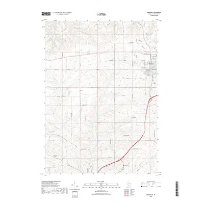
2018 Map of Dodgeville
USGS Topo · Published 2018About this map
Dodgeville serves as the primary hub of this Iowa County landscape, where the local street grid is intersected by the Dodgeville Expy. To the south, a portion of Mineral Point appears near the confluence of Brewery Cr and Mineral Point Br. The terrain is defined by a dense network of drainage systems, including Laxey Cr, Eusey Cr, and Mill Creek, which carve through the uplands. This area reflects a long-standing agricultural and transport-based economy, evidenced by the presence of the Iowa County Airport and the historic orientation of routes like Military Ridge Rd and the Cannonball Trl. Genealogists may find value in the various rural burial sites scattered across the township, such as Bloomfield Cem, Laxey Cem, and Saint Joseph Cem near the town center.
Find a feature on this map
89 named features on this map. Tap any name to fly to it.
Don’t see what you’re looking for? This feature index may not catch every label — zoom into the map to look around manually.
Map Details
Editions of this 2018 Dodgeville Map
This is the sole edition of this map. No revisions or reprints were ever made.
Other maps of this area

1902 · Mineral Point
USGS Topo · 1:125,000

1905 · Richland Center
USGS Topo · 1:125,000

1952 · Mineral Point
USGS Topo · 1:24,000

1952 · Dodgeville
USGS Topo · 1:24,000

1952 · Linden
USGS Topo · 1:24,000

1952 · Mifflin
USGS Topo · 1:24,000

1958 · La Crosse
USGS Topo · 1:250,000

1959 · Dubuque
USGS Topo · 1:250,000

1960 · Muscoda
USGS Topo · 1:62,500

1960 · Spring Green
USGS Topo · 1:62,500