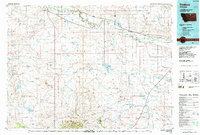
1984 Map of Dodson
USGS Topo · Published 1985About this map
The Fort Belknap Indian Reservation dominates the landscape of this mid-1980s topographic survey, stretching across the Blaine and Phillips County line. The northern corridor follows the vital lifeblood of the Milk River, where the Burlington Northern railroad links the grain and ranching outposts of Dodson, Savoy, and Wagner. While the river valley supports concentrated activity, the southern portion of the map rises into the northern reaches of the Little Rocky Mountains, a terrain marked by isolated peaks like Haystack Butte and Squaw Butte.
Find a feature on this map
52 named features on this map. Tap any name to fly to it.
Don’t see what you’re looking for? This feature index may not catch every label — zoom into the map to look around manually.
Map Details
Editions of this 1984 Dodson Map
This is the sole edition of this map. No revisions or reprints were ever made.
Other maps of this area

1903 · Wayne Creek
USGS Topo · 1:62,500

1904 · Chinook
USGS Topo · 1:62,500

1905 · Wayne Creek
USGS Topo · 1:62,500

1905 · Harlem
USGS Topo · 1:62,500

1912 · Zurich
USGS Topo · 1:125,000

1913 · Cherry Ridge
USGS Topo · 1:125,000

1920 · Avery
USGS Topo · 1:125,000

1920 · Cowan
USGS Topo · 1:125,000

1943 · Landusky
USGS Topo · 1:125,000

1953 · Havre
USGS Topo · 1:250,000