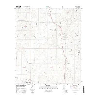
2015 Map of Dodson
USGS Topo · Published 2015About this map
Dodson serves as the central hub of this north-central Louisiana landscape, situated along the Us-167 corridor. The geography is defined by an intricate network of waterways, with the Saline Bayou and Hargiss Slough anchoring the southwestern reaches within the Kisatchie National Forest. This region is heavily drained by tributaries including Big Creek, Hurricane Creek, and Antwine Creek, reflecting the wet bottomlands of Winn Parish.
Find a feature on this map
85 named features on this map. Tap any name to fly to it.
Don’t see what you’re looking for? This feature index may not catch every label — zoom into the map to look around manually.
Map Details
Editions of this 2015 Dodson Map
This is the sole edition of this map. No revisions or reprints were ever made.
Other maps of this area

1947 · Goldonna
USGS Topo · 1:62,500

1949 · Calvin NE
USGS Topo · 1:31,680

1949 · Jonesboro
USGS Topo · 1:62,500

1950 · Jonesboro
USGS Topo · 1:62,500

1950 · Winnfield
USGS Topo · 1:62,500

1951 · Winnfield
USGS Topo · 1:62,500

1953 · Alexandria
USGS Topo · 1:250,000

1955 · Shreveport
USGS Topo · 1:250,000

1955 · Alexandria
USGS Topo · 1:250,000
1955 · Calvin
USGS Topo · 1:62,500