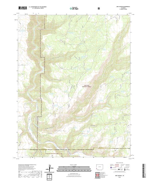
2022 Map of Doe Canyon
USGS Topo · Published 2022About this map
San Juan National Forest lands dominate this corner of Southwest Colorado, where the Dolores River winds through the deep corridor of Dolores Canyon. This landscape is defined by a dense network of water management features, including unique local names like Rabit Hash Reservoir, Pee Wee Reservoir, and Cheap Reservoir. These small catchments, alongside larger bodies like Bradfield Reservoir and McClure Reservoir, indicate the critical role of water storage in this high-elevation terrain for ranching or forest management.
Find a feature on this map
54 named features on this map. Tap any name to fly to it.
Don’t see what you’re looking for? This feature index may not catch every label — zoom into the map to look around manually.
Map Details
Editions of this 2022 Doe Canyon Map
This is the sole edition of this map. No revisions or reprints were ever made.
Other maps of this area

1956 · Cortez
USGS Topo · 1:250,000

1958 · Cortez
USGS Topo · 1:250,000

1959 · Cortez
USGS Topo · 1:250,000

1962 · Cortez
USGS Topo · 1:250,000

1964 · Glade Mountain
USGS Topo · 1:24,000
1964 · Secret Canyon
USGS Topo · 1:24,000

1964 · The Glade
USGS Topo · 1:24,000

1965 · Cahone
USGS Topo · 1:24,000

1965 · Yellow Jacket
USGS Topo · 1:24,000
1965 · Pleasant View
USGS Topo · 1:24,000