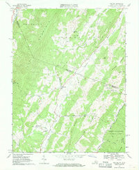
1968 Map of Doe Hill
USGS Topo · Published 1970About this map
The Bullpasture River valley serves as a primary corridor for settlement in this 1960s landscape, anchored by the community of Doe Hill. The map illustrates a rural society organized around small churches and river crossings, including McKendree Ch and Sirons Mill. To the west, the steep slopes of Jack Mountain rise sharply, while the George Washington National Forest covers the southeast, where the Cowpasture River and Carroll Draft drain the wooded terrain. This survey is particularly detailed regarding agricultural property lines, using fine red dashed lines to represent fences and field boundaries visible from the air. These markers, along with multiple family-named features like Totten Chapel and Botkin Ridge, provide significant material for genealogists and land use historians studying the Highland County backcountry.
Find a feature on this map
39 named features on this map. Tap any name to fly to it.
Don’t see what you’re looking for? This feature index may not catch every label — zoom into the map to look around manually.
Map Details
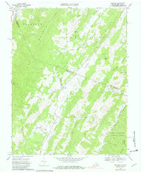
Editions of this 1968 Doe Hill Map
2 editions found
Other maps of this area

1889 · Beverly
USGS Topo · 1:125,000

1892 · Beverly
USGS Topo · 1:125,000

1892 · Franklin
USGS Topo · 1:125,000

1894 · Staunton
USGS Topo · 1:125,000

1896 · Franklin
USGS Topo · 1:125,000

1901 · Monterey
USGS Topo · 1:125,000

1922 · Spruce Knob
USGS Topo · 1:48,000

1922 · Circleville
USGS Topo · 1:62,500

1924 · Circleville
USGS Topo · 1:48,000

1924 · Mc Dowell
USGS Topo · 1:62,500