
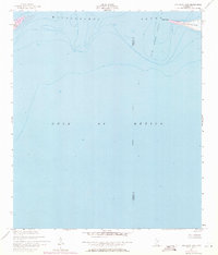
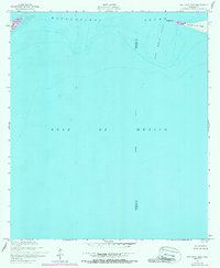
1950 Map of Dog Keys Pass
USGS Topo · Published 1958About this map
Dog Keys Pass serves as a critical maritime gateway in the mid-20th century, separating the eastern tip of Ship Island from the western reach of Horn Island. This hydrographic study, based on 1950 aerial photography and planetable surveys, documents the shifting coastal morphology of the Mississippi barrier islands before significant modern erosion and hurricane impacts altered their footprints. The map focuses on the deep-water transition between the Mississippi Sound and the open Gulf of Mexico, marking the maritime boundary between Harrison and Jackson counties. Notable landmarks like East Point and West Point define the narrow navigable channel. The presence of numerous soundings and depth curves illustrates the underwater topography of the pass, providing essential data for mid-century navigation and coastal research along this unprotected stretch of the Gulf coast.
Find a feature on this map
8 named features on this map. Tap any name to fly to it.
Don’t see what you’re looking for? This feature index may not catch every label — zoom into the map to look around manually.
Map Details
Editions of this 1950 Dog Keys Pass Map
3 editions found
Other maps of this area

1941 · Horn Island
USGS Topo · 1:62,500

1942 · Horn Island
USGS Topo · 1:62,500

1943 · Pascagoula
USGS Topo · 1:62,500

1950 · Ship Island
USGS Topo · 1:24,000

1951 · Chandeleur Light
USGS Topo · 1:24,000

1953 · Mobile
USGS Topo · 1:250,000

1954 · Deer Island
USGS Topo · 1:24,000

1954 · Biloxi
USGS Topo · 1:62,500

1955 · Pascagoula
USGS Topo · 1:62,500

1957 · Mobile
USGS Topo · 1:250,000