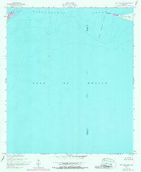
1950 Map of Dog Keys Pass
USGS Topo · Published 1988About this map
Dog Keys Pass serves as the primary focal point of this coastal hydrographic study, marking the critical maritime threshold where the Mississippi Sound meets the open Gulf of Mexico. The map details the shifting sands of the barrier islands during the mid-20th century, specifically the western extremity of Horn Island at West Point and the eastern tip of Ship Island. These landforms are essential to the navigation and ecology of the Mississippi coast, defining the boundary between the sheltered sound and the deeper gulf waters.
Find a feature on this map
8 named features on this map. Tap any name to fly to it.
Don’t see what you’re looking for? This feature index may not catch every label — zoom into the map to look around manually.
Map Details
Editions of this 1950 Dog Keys Pass Map
3 editions found
Other maps of this area

1941 · Horn Island
USGS Topo · 1:62,500

1942 · Horn Island
USGS Topo · 1:62,500

1943 · Pascagoula
USGS Topo · 1:62,500

1950 · Dog Keys Pass
USGS Topo · 1:24,000

1950 · Ship Island
USGS Topo · 1:24,000

1951 · Chandeleur Light
USGS Topo · 1:24,000

1953 · Mobile
USGS Topo · 1:250,000

1954 · Deer Island
USGS Topo · 1:24,000

1954 · Biloxi
USGS Topo · 1:62,500

1955 · Pascagoula
USGS Topo · 1:62,500