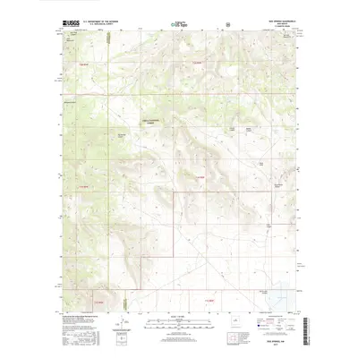
2017 Map of Dog Springs
USGS Topo · Published 2017About this map
Cibola National Forest lands dominate this high-altitude New Mexico landscape, straddling the border of Catron and Socorro counties. The terrain is defined by the sharp transition between the Datil Mountains in the northwest and the Gallinas Mountains to the northeast. Water management in this arid environment is evident through dispersed cattle tanks and springs, such as Gibson Tank, Taylor Tank, and the namesake Dog Springs. Deep drainage systems like Thompson Canyon, Chavez Canyon, and Rock House Canyon carve through the forested uplands. To the southeast, the geography softens near North Lake, a significant local water feature. The network of primitive roads, including Co RD 1, follows the natural contours of the canyons, tracing the same paths used for decades to access these remote timber and grazing lands.
Find a feature on this map
25 named features on this map. Tap any name to fly to it.
Don’t see what you’re looking for? This feature index may not catch every label — zoom into the map to look around manually.
Map Details
Editions of this 2017 Dog Springs Map
This is the sole edition of this map. No revisions or reprints were ever made.
Other maps of this area

1954 · Socorro
USGS Topo · 1:250,000

1958 · Socorro
USGS Topo · 1:250,000

1962 · Socorro
USGS Topo · 1:250,000

1963 · Cal Ship Mesa
USGS Topo · 1:24,000

1963 · Datil
USGS Topo · 1:24,000

1964 · Indian Mesa
USGS Topo · 1:24,000

1964 · Table Mountain
USGS Topo · 1:24,000

1964 · Dog Springs
USGS Topo · 1:24,000

1964 · Pasture Canyon
USGS Topo · 1:24,000

1964 · Lion Mountain
USGS Topo · 1:24,000