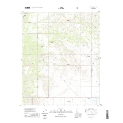
2020 Map of Dog Springs
USGS Topo · Published 2020About this map
Cibola National Forest encompasses this high-elevation landscape, where the Datil Mountains and Gallinas Mountains dominate the horizon. This 2020 topographic record shows a terrain defined by deep drainages like Dog Springs Canyon and Rock Tank Canyon, revealing the intricate hydrological patterns of the Socorro and Catron county line. Water management is a primary feature of the region, evidenced by numerous livestock or catchment points such as Gibson Tank, Taylor Tank, and the naturally occurring Rock Hole. In the southeast, North Lake and its corresponding North Lake Canyon provide a focal point for the local drainage system. The map documents the presence of Dog Springs, a critical water source in this arid environment, and traces the primary transit corridor along the winding CO RD that navigates the complex system of canyons and ridges.
Find a feature on this map
25 named features on this map. Tap any name to fly to it.
Don’t see what you’re looking for? This feature index may not catch every label — zoom into the map to look around manually.
Map Details
Editions of this 2020 Dog Springs Map
This is the sole edition of this map. No revisions or reprints were ever made.
Other maps of this area

1954 · Socorro
USGS Topo · 1:250,000

1958 · Socorro
USGS Topo · 1:250,000

1962 · Socorro
USGS Topo · 1:250,000

1963 · Cal Ship Mesa
USGS Topo · 1:24,000

1963 · Datil
USGS Topo · 1:24,000

1964 · Indian Mesa
USGS Topo · 1:24,000

1964 · Table Mountain
USGS Topo · 1:24,000

1964 · Dog Springs
USGS Topo · 1:24,000

1964 · Pasture Canyon
USGS Topo · 1:24,000

1964 · Lion Mountain
USGS Topo · 1:24,000