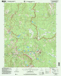
2004 Map of Dogtooth Peak
USGS Topo · Published 2007About this map
The Dinkey Pendent Geological Area anchors the southwest corner of this high-altitude landscape, where the granite peaks and glacial basins of the Sierra National Forest meet. The terrain is defined by a dense network of subalpine lakes and meadows, including First Dinkey Lake, South Lake, and the expansive Lakecamp Meadow. Human activity is primarily limited to primitive transportation corridors like the Strawberry 4wd Route and the Coyote 4wd Route, which navigate the steep elevations near Red Mountain. Evidence of early 20th-century exploration and industry appears at the Rainbow Mine and Miningtown Meadow, illustrating the era's mining interests in the backcountry. Large portions of the territory are protected within the John Muir Wilderness and Dinky Lakes Wilderness, where the landscape remains dominated by natural features like the prominent Three Sisters and the 10,000-foot summit of Dogtooth Peak.
Find a feature on this map
53 named features on this map. Tap any name to fly to it.
Don’t see what you’re looking for? This feature index may not catch every label — zoom into the map to look around manually.
Map Details
Editions of this 2004 Dogtooth Peak Map
This is the sole edition of this map. No revisions or reprints were ever made.
Other maps of this area

1904 · Kaiser
USGS Topo · 1:125,000

1912 · Mt. Goddard
USGS Topo · 1:125,000

1947 · Mariposa
USGS Topo · 1:250,000

1948 · Mariposa
USGS Topo · 1:250,000

1953 · Mt Abbot
USGS Topo · 1:62,500

1953 · Huntington Lake
USGS Topo · 1:62,500

1953 · Blackcap Mtn
USGS Topo · 1:62,500

1953 · Kaiser Peak
USGS Topo · 1:62,500

1957 · Mariposa
USGS Topo · 1:250,000
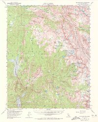
1962 · Blackcap Mtn
USGS Topo · 1:62,500