
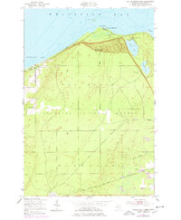
1951 Map of Dollar Settlement
USGS Topo · Published 1955About this map
The shoreline of Whitefish Bay and Pendills Bay defines this coastal stretch of Chippewa County, where local life centered around the namesake Dollar Settlement. This mid-century survey reveals a community equipped with its own Dollar Settlement Sch and Dollar Settlement Cem, situated just inland from the Iroquois Road. Further east, the topography rises toward Mission Hill, which features a Lookout Tower and the Mission Hill Cem overlooking the waters of Monocle Lake and Spectacle Lake.
Find a feature on this map
24 named features on this map. Tap any name to fly to it.
Don’t see what you’re looking for? This feature index may not catch every label — zoom into the map to look around manually.
Map Details
Editions of this 1951 Dollar Settlement Map
2 editions found
Other maps of this area

1941 · Strongs
USGS Topo · 1:63,360

1941 · Brimley
USGS Topo · 1:63,360

1951 · Pendills Lake
USGS Topo · 1:24,000

1951 · Sullivan Creek
USGS Topo · 1:24,000

1951 · Raco
USGS Topo · 1:24,000

1951 · Kinross
USGS Topo · 1:24,000

1951 · Brimley
USGS Topo · 1:62,500

1951 · Strongs
USGS Topo · 1:62,500

1951 · Brimley
USGS Topo · 1:24,000

1954 · Sault Sainte Marie
USGS Topo · 1:250,000