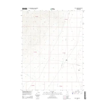
2014 Map of Dolly Varden
USGS Topo · Published 2014About this map
Dolly Varden sits at the base of rising terrain where the high desert transitions into the broad expanse of the Goshute Valley. This 2014 survey captures a landscape defined by its remote transit routes and seasonal watercourses, with Shafter Rd and Dolly Varden Spring Rd serving as the primary arteries through the eastern Elko County wilderness. The topography is marked by significant elevation changes, particularly around Ninemile Cyn, while drainage is provided by intermittent features like Indian Cr and Nelson Cr. The map illustrates the structured Bureau of Land Management grid system, dividing the territory into townships including t31n r66e and t32n r66e, which govern this sparsely populated region of northeastern Nevada.
Find a feature on this map
13 named features on this map. Tap any name to fly to it.
Don’t see what you’re looking for? This feature index may not catch every label — zoom into the map to look around manually.
Map Details
Editions of this 2014 Dolly Varden Map
This is the sole edition of this map. No revisions or reprints were ever made.
Other maps of this area

1953 · Spruce Mountain 4
USGS Topo · 1:62,500

1955 · Elko
USGS Topo · 1:250,000

1958 · Elko
USGS Topo · 1:250,000

1962 · Elko
USGS Topo · 1:250,000

1965 · Elko
USGS Topo · 1:250,000

1971 · Decoy
USGS Topo · 1:24,000

1972 · Decoy SW
USGS Topo · 1:24,000
1982 · White Horse Mountain NW
USGS Topo · 1:24,000

1982 · Mizpah
USGS Topo · 1:24,000
1982 · Mizpah Point
USGS Topo · 1:24,000