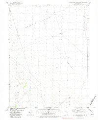
1982 Map of White Horse Mountain NW
USGS Topo · Published 1982About this map
Goshute Valley and Antelope Valley converge in this high-desert landscape of Elko County, Nevada, as it appeared in the early 1980s. The terrain is defined by its sparse water sources and utilitarian ranching or mining infrastructure. A single prospect sits near the base of the mountains in the southwest, suggesting mineral exploration in an area otherwise dominated by open range. Water management is the primary evidence of human activity, represented by scattered wells and a cluster of Water Tanks in the southern reaches. The drainage of North Creek provides a rare riparian corridor through the dry valley floor, while a network of Jeep Trails provides the only access across the vast basin. This map serves as a detailed record of the region's essential landmarks for land management and geological study before modern developments.
Find a feature on this map
7 named features on this map. Tap any name to fly to it.
Don’t see what you’re looking for? This feature index may not catch every label — zoom into the map to look around manually.
Map Details
Editions of this 1982 White Horse Mountain NW Map
This is the sole edition of this map. No revisions or reprints were ever made.
Other maps of this area

1953 · Spruce Mountain 4
USGS Topo · 1:62,500

1955 · Elko
USGS Topo · 1:250,000

1958 · Elko
USGS Topo · 1:250,000

1962 · Elko
USGS Topo · 1:250,000

1965 · Elko
USGS Topo · 1:250,000

1972 · Lion Spring
USGS Topo · 1:24,000

1972 · Decoy SW
USGS Topo · 1:24,000
1982 · Goshute Peak
USGS Topo · 1:24,000

1982 · Sharp Peak
USGS Topo · 1:24,000
1982 · Dolly Varden Spring
USGS Topo · 1:24,000