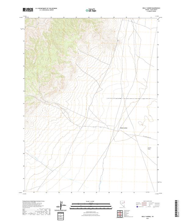
2021 Map of Dolly Varden
USGS Topo · Published 2021About this map
Goshute Valley provides the topographic focus for this portion of Elko County, where the high desert terrain meets the eastern slopes of the mountains. The settlement of Dolly Varden is positioned at the intersection of local routes, including Dolly Varden Spring Rd, serving as a central point in an otherwise expansive landscape. The drainage patterns of the area are defined by several seasonal waterways, most notably Indian Cr and Nelson Cr, which flow through the basin floors. Produced by the U.S. Geological Survey, this 2021 study reflects the modern land management boundaries, including several townships and ranges such as t31n r66e and t31n r65e. The map detail highlights the sparse infrastructure and remote character of this Nevada interior, capturing the essential geography of the valley and its mountain fringes.
Find a feature on this map
11 named features on this map. Tap any name to fly to it.
Don’t see what you’re looking for? This feature index may not catch every label — zoom into the map to look around manually.
Map Details
Editions of this 2021 Dolly Varden Map
This is the sole edition of this map. No revisions or reprints were ever made.
Other maps of this area

1953 · Spruce Mountain 4
USGS Topo · 1:62,500

1955 · Elko
USGS Topo · 1:250,000

1958 · Elko
USGS Topo · 1:250,000

1962 · Elko
USGS Topo · 1:250,000

1965 · Elko
USGS Topo · 1:250,000

1971 · Decoy
USGS Topo · 1:24,000

1972 · Decoy SW
USGS Topo · 1:24,000
1982 · White Horse Mountain NW
USGS Topo · 1:24,000

1982 · Mizpah
USGS Topo · 1:24,000
1982 · Mizpah Point
USGS Topo · 1:24,000