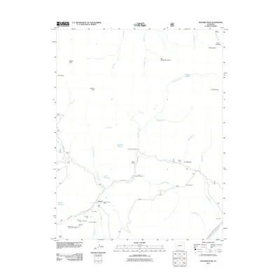
2011 Map of Dolores Peak
USGS Topo · Published 2011About this map
Dunton and its surrounding high-altitude terrain define this 2011 survey, centered on the historic mining district along the West Dolores River. The landscape is densely packed with 19th and 20th-century extraction history, featuring numerous named claims such as the Smuggler Mine, Emma Mine, and Sulphur Queen Group Mine. These sites sit at the feet of massive peaks like Dolores Peak and El Diente Peak, illustrating the extreme conditions of Colorado’s mineral rushes. In the valley, Dunton Hot Spring serves as a primary landmark near the junction of Dunton Rd and Fall Creek. Traces of industrial infrastructure remain visible in labels like the Coke Oven and the Silver Pick Mill near the Silver Pick Basin. Away from the mines, the map details the recreation and water management of the modern era, including the Tom Akin Reservoir, Navajo Lake Trailhead, and Burro Bridge Campground.
Find a feature on this map
49 named features on this map. Tap any name to fly to it.
Don’t see what you’re looking for? This feature index may not catch every label — zoom into the map to look around manually.
Map Details
Editions of this 2011 Dolores Peak Map
This is the sole edition of this map. No revisions or reprints were ever made.
Other maps of this area

1897 · Rico
USGS Topo · 1:62,500

1897 · Telluride
USGS Topo · 1:62,500

1898 · Engineer Mountain
USGS Topo · 1:62,500

1898 · Rico
USGS Topo · 1:62,500

1899 · Rico
USGS Topo · 1:62,500

1900 · Engineer Mountain
USGS Topo · 1:62,500

1904 · Telluride
USGS Topo · 1:62,500

1908 · Engineer Mountain
USGS Topo · 1:62,500

1945 · Durango
USGS Topo · 1:250,000

1953 · Mount Wilson
USGS Topo · 1:24,000