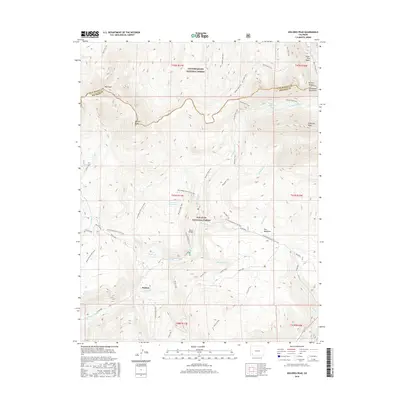
2016 Map of Dolores Peak
USGS Topo · Published 2016About this map
Dunton and its celebrated Dunton Hot Spring serve as the primary human anchor in this high-altitude landscape where the Uncompahgre National Forest meets the San Juan National Forest. The map documents a rugged transition across the San Miguel Mountains, featuring prominent summits like Dolores Peak and El Diente Peak. A complex network of historic routes and water management features is evident, including the long Groundhog Stock Drive Trail and the Tom Akin Reservoir. Local topography is further defined by the Silver Pick Basin and Navajo Basin, providing a detailed look at the drainage systems of the W Dolores River and its numerous tributaries such as Kilpacker Cr and Fall Cr. This 2016 survey captures the area's modern character as a site of seasonal recreation and conservation, centered around the historic settlement at Dunton.
Find a feature on this map
54 named features on this map. Tap any name to fly to it.
Don’t see what you’re looking for? This feature index may not catch every label — zoom into the map to look around manually.
Map Details
Editions of this 2016 Dolores Peak Map
This is the sole edition of this map. No revisions or reprints were ever made.
Other maps of this area

1897 · Rico
USGS Topo · 1:62,500

1897 · Telluride
USGS Topo · 1:62,500

1898 · Engineer Mountain
USGS Topo · 1:62,500

1898 · Rico
USGS Topo · 1:62,500

1899 · Rico
USGS Topo · 1:62,500

1900 · Engineer Mountain
USGS Topo · 1:62,500

1904 · Telluride
USGS Topo · 1:62,500

1908 · Engineer Mountain
USGS Topo · 1:62,500

1945 · Durango
USGS Topo · 1:250,000

1953 · Mount Wilson
USGS Topo · 1:24,000