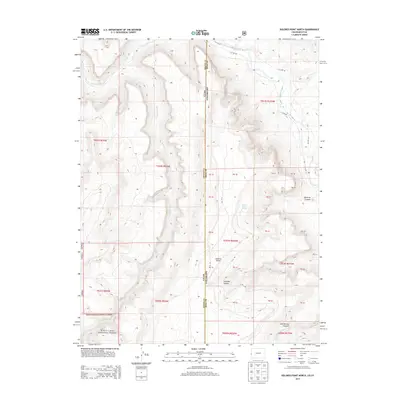
2013 Map of Dolores Point North
USGS Topo · Published 2013About this map
Manti-LaSal National Forest anchors the southwestern portion of this map, which tracks the high-altitude border where Grand County, Utah, meets Mesa County, Colorado. This 2013 survey illustrates the dramatic drainage patterns of the Dolores River and its tributaries, including the deeply incised Beaver Creek. The landscape is defined by its topographic extremes, from the high vantage of Dolores Point to the sheltered depths of Lumsden Canyon and John Brown Canyon. Remote resource points such as Dolores Point Spring are noted alongside a network of specialized routes like ZS 10 Rd and 4 25/100 Rd, which provide access to this complex canyon system. The map serves as a detailed record of the public land survey system and federal forest boundaries in a region where geological features dictate the flow of transportation and water.
Find a feature on this map
36 named features on this map. Tap any name to fly to it.
Don’t see what you’re looking for? This feature index may not catch every label — zoom into the map to look around manually.
Map Details
Editions of this 2013 Dolores Point North Map
This is the sole edition of this map. No revisions or reprints were ever made.
Other maps of this area

1885 · La Sal
USGS Topo · 1:250,000

1949 · Juanita Arch
USGS Topo · 1:24,000

1949 · Gateway
USGS Topo · 1:24,000

1950 · Juanita Arch
USGS Topo · 1:24,000

1952 · Gateway
USGS Topo · 1:24,000

1954 · Mt. Waas 4 SE
USGS Topo · 1:24,000

1954 · Mt. Waas 4 SW
USGS Topo · 1:24,000

1954 · Mt. Waas 4 NE
USGS Topo · 1:24,000

1954 · Mt. Waas 4 NW
USGS Topo · 1:24,000

1954 · Mt. Waas 1 SW
USGS Topo · 1:24,000