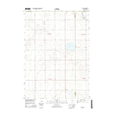
2015 Map of Dolton
USGS Topo · Published 2015About this map
Dolton sits at the northeastern corner of this prairie landscape, where the township line between Hutchinson Co and Turner Co divides the agricultural grid. This 2015 survey illustrates a region defined by its Section Line roads and scattered water features, most notably Silver Lake, which occupies a large basin in the center-east. The map preserves several locations significant for local genealogy, including Schartner Cem near the eastern boundary and Tschetter Cem to the south along 276th St. The terrain is characterized by numerous small depressions and seasonal wetlands typical of the glaciated plains, woven through by an orderly network of avenues and streets that follow the original Public Land Survey System divisions of T100N and T99N.
Find a feature on this map
28 named features on this map. Tap any name to fly to it.
Don’t see what you’re looking for? This feature index may not catch every label — zoom into the map to look around manually.
Map Details
Editions of this 2015 Dolton Map
This is the sole edition of this map. No revisions or reprints were ever made.
Other maps of this area

1898 · Olivet
USGS Topo · 1:125,000

1898 · Parker
USGS Topo · 1:125,000

1899 · Alexandria
USGS Topo · 1:125,000

1955 · Sioux Falls
USGS Topo · 1:250,000

1957 · Wolf Creek
USGS Topo · 1:24,000

1958 · Sioux Falls
USGS Topo · 1:250,000

1964 · Canistota
USGS Topo · 1:24,000

1964 · Bridgewater East
USGS Topo · 1:24,000

1970 · Clayton NE
USGS Topo · 1:24,000

1970 · Freeman SE
USGS Topo · 1:24,000