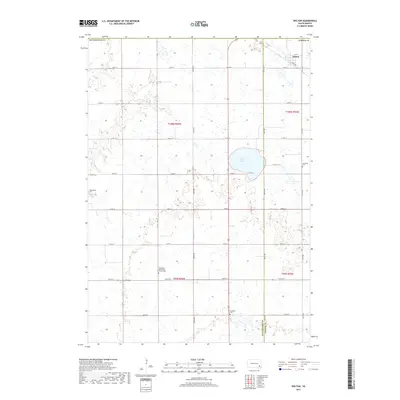
2017 Map of Dolton
USGS Topo · Published 2017About this map
The small settlement of Dolton sits in the northeast corner of this prairie landscape, situated along a prominent Railroad line at the boundary of Turner and Hutchinson Counties. This 2017 survey illustrates the sparse, grid-dependent development of the region, where a series of family-named cemeteries serve as the primary landmarks for researchers and genealogists. From the Kleinkassell Cem in the west to the Schartner Cem in the east, these burial grounds often represent the legacy of early Mennonite settlers. Near the center of the quadrangle, Silver Lake provides a rare break in the agricultural topography. Local religious history is anchored by the Hutterthal Mennonite Church Cem, while the southern portion of the map includes the small Tschetter Cem, reflecting the deep familial roots tied to the township's sections and range lines.
Find a feature on this map
25 named features on this map. Tap any name to fly to it.
Don’t see what you’re looking for? This feature index may not catch every label — zoom into the map to look around manually.
Map Details
Editions of this 2017 Dolton Map
This is the sole edition of this map. No revisions or reprints were ever made.
Other maps of this area

1898 · Olivet
USGS Topo · 1:125,000

1898 · Parker
USGS Topo · 1:125,000

1899 · Alexandria
USGS Topo · 1:125,000

1955 · Sioux Falls
USGS Topo · 1:250,000

1957 · Wolf Creek
USGS Topo · 1:24,000

1958 · Sioux Falls
USGS Topo · 1:250,000

1964 · Canistota
USGS Topo · 1:24,000

1964 · Bridgewater East
USGS Topo · 1:24,000

1970 · Clayton NE
USGS Topo · 1:24,000

1970 · Freeman SE
USGS Topo · 1:24,000