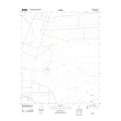
2011 Map of Dome
USGS Topo · Published 2011About this map
The Gila River corridor near the settlement of Dome reveals a desert landscape defined by ephemeral waterways and historic transit routes. This area is famously traversed by the Route of Butterfield Stage, marking the path of the mid-19th-century overland mail line that once connected the eastern United States to California. The terrain is dominated by complex drainage systems, including Castle Dome Wash, Vinegarroon Wash, and Nugget Wash, which cut through the arid flats and lead toward prominent geological features like Muggins Mesa and the spire of Klothos Temple. Along the southern edge, a network of county roads such as S Avenue 16 E and E Co Hwy 4th serves the small community of Dome, providing a window into the modern rural infrastructure of Yuma County.
Find a feature on this map
23 named features on this map. Tap any name to fly to it.
Don’t see what you’re looking for? This feature index may not catch every label — zoom into the map to look around manually.
Map Details
Editions of this 2011 Dome Map
This is the sole edition of this map. No revisions or reprints were ever made.
Other maps of this area

1926 · Fortuna
USGS Topo · 1:62,500

1926 · Wellton
USGS Topo · 1:62,500

1929 · Fortuna
USGS Topo · 1:62,500

1929 · Laguna
USGS Topo · 1:62,500

1929 · Wellton
USGS Topo · 1:62,500

1942 · Yuma
USGS Topo · 1:250,000

1943 · Laguna
USGS Topo · 1:62,500

1954 · El Centro
USGS Topo · 1:250,000

1955 · El Centro
USGS Topo · 1:250,000
1955 · Dome
USGS Topo · 1:24,000