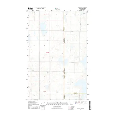
2014 Map of Dominek Lake
USGS Topo · Published 2014About this map
Dominek Lake sits at the center of this high-plains landscape where the borders of Montana and North Dakota meet. The terrain is defined by a series of depressions and small water bodies, including Camp Lake and the headwaters of Lake Cr. This 2014 survey documents the sparse, gridded road network of the Missouri Plateau, where long-distance routes like Sand Flat Rd and Syverud Rd serve the surrounding agricultural sections. A significant landmark for local history and genealogy is the Immanuel Cem, located near the intersection of several section lines. The map also captures the administrative convergence of three counties: Sheridan County in Montana, and Divide and Williams counties in North Dakota, illustrating how geopolitical boundaries were drawn across this open prairie environment.
Find a feature on this map
25 named features on this map. Tap any name to fly to it.
Don’t see what you’re looking for? This feature index may not catch every label — zoom into the map to look around manually.
Map Details
Editions of this 2014 Dominek Lake Map
This is the sole edition of this map. No revisions or reprints were ever made.
Other maps of this area

1946 · Brush Lake
USGS Topo · 1:24,000

1946 · Dagmar
USGS Topo · 1:24,000

1948 · Grenora
USGS Topo · 1:24,000

1948 · Dagmar
USGS Topo · 1:24,000

1948 · Brush Lake
USGS Topo · 1:24,000

1953 · Williston
USGS Topo · 1:250,000

1954 · Wolf Point
USGS Topo · 1:250,000

1957 · Williston
USGS Topo · 1:250,000

1958 · Wolf Point
USGS Topo · 1:250,000

1983 · Tadpole Lake
USGS Topo · 1:24,000