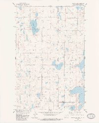
1983 Map of Dominek Lake
USGS Topo · Published 1984About this map
Daneville and Fertile Valley characterize the prairie landscape where the Montana and North Dakota borders meet. This survey, updated in the early 1980s, documents a high-plains region defined by a mixture of agricultural activity and energy extraction. Numerous wells, including specific Oil Wells and a Drill Hole, are scattered across the terrain, indicating the development of the Williston Basin during this period.
Find a feature on this map
17 named features on this map. Tap any name to fly to it.
Don’t see what you’re looking for? This feature index may not catch every label — zoom into the map to look around manually.
Map Details
Editions of this 1983 Dominek Lake Map
This is the sole edition of this map. No revisions or reprints were ever made.
Other maps of this area

1946 · Brush Lake
USGS Topo · 1:24,000

1946 · Dagmar
USGS Topo · 1:24,000

1948 · Grenora
USGS Topo · 1:24,000

1948 · Dagmar
USGS Topo · 1:24,000

1948 · Brush Lake
USGS Topo · 1:24,000

1953 · Williston
USGS Topo · 1:250,000

1954 · Wolf Point
USGS Topo · 1:250,000

1957 · Williston
USGS Topo · 1:250,000

1958 · Wolf Point
USGS Topo · 1:250,000

1983 · Tadpole Lake
USGS Topo · 1:24,000